Teacher Tips for Teaching World Geography #2: Geographic Patterns & Process of Continents, Landforms, Bodies of Water, & Countries
Analyze geographic patterns and processes using spatial knowledge of the world’s continents, major landforms, major bodies of water, and major countries. Membership for World Geography
SIGN UP NOW for World Geography teacher tips, quick references, and free materials.
This standard requires students to use their spatial and geographic knowledge to understand and analyze patterns and processes that shape our world.
Here’s how educators can guide students to meet this standard:
1. Understanding Basic Geographic Features
Continents: Ensure students can identify the seven continents (Africa, Antarctica, Asia, Europe, North America, Australia/Oceania, South America) and understand their relative positions and significance.
Major Landforms: Teach about mountain ranges (e.g., the Himalayas, Rockies, Andes), plateaus (e.g., the Tibetan Plateau), deserts (e.g., Sahara, Gobi), and plains (e.g., Great Plains of the USA).
Bodies of Water: Cover the identification and characteristics of major oceans (Atlantic, Pacific, Indian, Arctic, Southern), seas (Mediterranean, Caribbean, South China), major rivers (Amazon, Nile, Yangtze), and lakes (Superior, Victoria, Baikal).
2. Analyzing Geographic Patterns
Climate and Weather Patterns: Examine how major landforms and bodies of water influence climate zones and weather patterns, such as how mountain ranges affect rainfall (orographic precipitation) or how ocean currents influence coastal climates.
Biogeography: Study how physical geography influences the distribution of species and ecosystems, for example, how different animals and plants are adapted to environments from tropical rainforests to arid deserts.
Human Settlements and Activities: Analyze how geography influences human behaviors and settlement patterns, including urbanization, agricultural practices, and the location of major cities.
3. Exploring Geographic Processes
Tectonic Activities: Understand the role of plate tectonics in creating major landforms like mountains and rift valleys.
Erosion and Deposition: Investigate how water and wind reshape landscapes through processes such as erosion, sediment transport, and deposition.
Environmental Changes: Discuss how natural and human-induced changes (e.g., deforestation, climate change) affect geographic patterns and processes.
4. Utilizing Spatial Knowledge
Maps and GIS: Employ maps and Geographic Information Systems (GIS) to visualize, analyze, and interpret geographic data. This includes understanding how to read different types of maps (political, physical, topographic) and use digital tools to explore geographic information.
Spatial Thinking: Develop spatial reasoning skills to understand how different geographic elements relate to each other. This involves exercises in mental mapping, spatial analysis, and predictive geography.
5. Case Studies and Applications
Case Studies: Use specific examples and case studies to illustrate geographic concepts, such as studying the Amazon River Basin to understand ecological biodiversity or examining the effects of the Himalayas on South Asian climates.
Field Work: Encourage field trips or virtual tours of significant geographical features or major urban centers to provide practical experience in observing geographic patterns and processes.
By engaging students in these activities, educators can help them develop a comprehensive understanding of how geographic patterns and processes are interconnected across the globe. This knowledge not only contributes to their academic growth but also helps them become more informed global citizens. Membership for World Geography
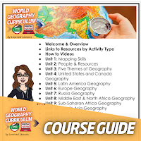
My Curriculum Materials are Available in a Membership for World Geography:
Full World Geography curriculum in print and google apps
Curriculum support
Live updates
They are also available on my TPT Store:
Basic Geography Maps and Skills Geography Curriculum Bundle
Five Themes of Geography, Landforms and Waterways Geography Curriculum Bundle
People and Resources (Population, Culture, Resources and Land Use) Geography Curriculum Bundle
United States and Canada Geography Curriculum Bundle
Latin America Geography Curriculum Bundle
Europe Geography Curriculum Bundle
Russia and Eurasia Geography Curriculum Bundle
Russia and Eurasia Geography Curriculum Bundle
Sub-Saharan Africa Geography Curriculum Bundle
South Asia Geography Curriculum Bundle
East Asia Geography Curriculum Bundle
Southeast Asia Geography Curriculum Bundle
Australia Geography Curriculum Bundle
My favorite websites to support World Geography:
National Geographic National Geographic is a go to site for articles, images, and current events.
Membership for World Geography
Membership for World Geography


